CALLI-fornia BULL SITTING
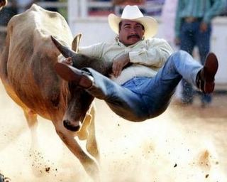
You know there is nothing like sitting down and having a nice chat with Calli, once you get her down that is..........Stubborn as a what? Yee Haw! Riddum Cowboy!

posted by MYSTIC @ 10:31 PM
4 comments
![]()